Take a hike: 5 majestic trails in Greater Cincinnati
Outdoor enthusiast Tamara York is our trusty guide with tips to get properly prepared plus a free bonus hike too.
This week, many of the area’s schools let out for the summer. Many parents, extended family, and caregivers seek opportunities to extricate their kids (and themselves) from screens and savor the Greater Cincinnati area’s abundant and beautiful parks and greenspaces.
However, those unfamiliar with the topography and challenges posed by specific parks and trails could feel uneasy with navigating unfamiliar terrain. Not to worry; Tamara York is on the case. A longtime hiking and outdoors enthusiast, she’s traversed most of the region’s best hiking destinations (and many of the rest as well). She had to learn their every nuance through experience, and lamented the lack of an easy-to-use reference tool to prepare for rugged al fresco journeys.
Her hiking experience, buttressed by her more than 20 years spent working for Ohio and Indiana’s Departments of Natural Resources and deep knowledge of and appreciation for the natural world, inspired her to write the Cincinnati edition of 60 Hikes Within 60 Miles, which was originally released in 2014 and updated with a third edition in 2021. Sister publications have been released for 27 other metro areas.
Delving into 60 greenspaces would venture far into TLDR territory (and Tamara might not appreciate giving away the book’s entire contents gratis), so we chatted with Tamara about five noted hiking destinations that represent diverse degrees of complexity, features, and proximity. They’re not listed by geography or rank, simply alphabetically (if a statistician cares to determine the odds of a random five-item alphabetical list ending with “Cincinnati,” please report your findings).
She also provided a few helpful hints to be prepared for a lengthy trek. (See Get the right gear in the right sidebar.)
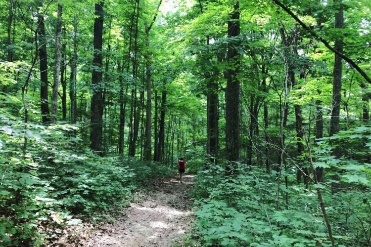
Bender Mountain
Located on more than 120 acres of hillside between Bender Road and Hillside Avenue in Delhi Township, Bender Mountain Loop trail provides a 2.3-mile loop with a 404-ft. elevation rise which rates on the easier side of the challenge spectrum. Many spots along the loop provide scenic views of the Ohio River, and wildflowers and wildlife embellish the scene.
“Bender Mountain is actually located with the CVG flight path, so the animals near the trail are used to loud noises, so they won’t be skittish when people approach,” York said.
The greenspace formerly spanned approximately 50 acres, but more than doubled in size last summer when the Sisters of Charity of Cincinnati gifted 73 acres located near the Mt. St. Joseph motherhouse property. The agreement affirms that the parcel will remain under conservation and undeveloped.
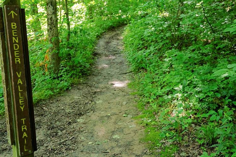
Blue Licks Battlefield State Park
Located near Maysville, an hour from Cincinnati, Blue Licks Battlefield State Park was opened in 1927, when area residents donated 32 acres. Its battlefield designation stems from numerous skirmishes between settlers and Native Americans, as well as a conflict on August 19, 1782, which is referred to the last battle of the Revolutionary War.
The Park has been augmented to more than 1,000 acres, with a 3.1-mile trail hiking loop of moderate difficulty, and features a reproduction of the Tanner Station pioneer outpost encased within an imposing cedar fence. Tanner Station, originally built over a spring, was used to make and store salt.
Much of the trail is comprised of flat meadows, but the path eventually leads into a wooded area shaded by buckeye, hackberry, and basswood trees. The path includes a nature preserve that features Short’s goldenrod, a flower that was Kentucky’s first plant placed on the U.S. Fish and Wildlife Service’s endangered species list. According to Wikipedia, Indiana’s Harrison-Crawford State Forest is the only other place where it exists.
“The trail intersects with Buffalo Trace Trail, which is one of the major paths buffalo that used to live in the area followed,” York said.
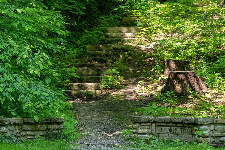
Buzzardroost Rock Preserve
Located in Adams County, Buzzardroost spans a 4.3-mile trail that provides moderate-to-challenging terrain that shifts between open prairies and heavily wooded areas. It’s jointly operated by The Nature Conservancy and the Cincinnati Museum of Natural History, and was first opened to the public in 1967 as a tribute to Christian and Emma Goetz, a sibling duo instrumental in the creation of Adams County nature preserve.
In 60 Miles, York notes that limestone, shale, and dolomite occur abundantly within Buzzardroost, and that the rich calcium deposits created a hospitable habitat for 67 snail species. Eventually, the rock terrain yields to newer-growth forest, including red cedar, hickory, oak, black locust, and sugar maple trees, among many others, which grow well in Appalachian shale woodlands. Its prairies are extremely biodiverse, with more than 1,100 plant species, including crested coralroot orchids and purple coneflowers.
“This is a great place for birdwatching,” York said. “You’ll see woodpeckers, tanagers, and nuthatches. And, as the name would suggest, black and turkey vultures commonly soar above the trail.”
California Woods Nature Preserve
One hundred thirteen of California Woods’ 114 acres classifies as forest, making it a canopied oasis on the city’s lower east side. The 3.7-mile series of well-maintained trails rate on the easy-to-moderate end of the scale.
Wildflowers paint the Preserve with a rich palette of color with such varieties as blue phlox, downy yellow violet, light-purple waterleafs, and white trilliums, among others.
A log cabin stands near the Preserve’s entry, and the path winds uphill through a heavy growth of sugar maples, that’s complemented by buckeyes, sycamores, and black-cherry trees. Deer will occasionally greet trail goers, but birds, such as woodpeckers and nuthatches, and butterflies are the primary Preserve occupants. Along Lick Run Creek, which winds through the park, water-loving birds such as the great blue heron and belted kingfisher are periodic visitors, and muskrats and beavers can occasionally be seen hard at work.
On the Preserve’s “T” Trail, the path reveals a large sycamore tree, which York refers to as a possible “sign” tree, which were created by Native American tribes in the eastern U.S. With a serpentine “Z’ or “4” shape, sign trees form by bending a tying a young, pliable sapling into atypical shapes to create a marker for a trail or signifier of where to locate water, buffalo, or some other necessity.
One section of the Preserve’s wildflowers is ensconced in an area flanked deer deterrents as a contrast vegetation undisturbed versus those where deer graze freely to study their impact on vegetation growth.
Such verdant, beautiful “breathing room” is undoubtedly a welcome addition to Hamilton County.
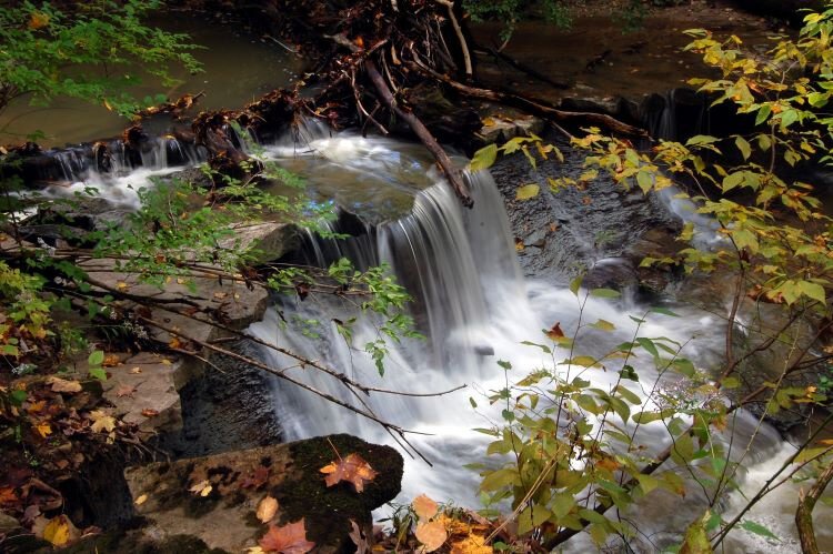
A waterfall provides a breathtaking Cincinnati Nature Center vista.
Cincinnati Nature Center Rowe Woods
Located on Tealtown Road in Milford, the Cincinnati Nature Center (CNC) encompasses 1,657 acres and Rowe Woods, one of CNC’s two sites, provides an 8.9-mil trail loop that York defines as challenging. However, its beauty more than justifies its difficult terrain. One of its signature blandishments its annual explosion of thousands of daffodils, a lingering tribute to Mary and Carl Krippendorf, who began planting them in the early 20th Century and lived in a home on what’s now Nature Center grounds until their deaths in 1965. A group of relatives and community leaders incorporate the property as the Cincinnati Nature Center Association to protect the land from development, establishing the mission statement “To enrich lives by inspiring passion for nature through experience, education, and stewardship.”
The trail’s expansive path provides ample picturesque overlooks and lush biodiversity. Whitetail Trace reveals a pond overlook where songbirds and waterfowl congregate. Redwing Trail passes uphill from an open field to a canopy of sassafras, hackberry, and sugar maple trees. Geology Trail’s rocky terrain yields to Wildflower Trail, which showcases more than 100 native plants with staggered blooming seasons that ensure a colorful path from April through October.
The CNC provides numerous complements to the hiking experience that boost enjoyment and reflections for multiple generations of visitors, including a playhouse, café, and sizeable birdwatching area with feeders to attract winged friends.
As a bonus, courtesy of Tamara, click this link for access to a free hike.
60 Hikes within 60 Miles Cincinnati by Tamara York is published by Menasha Ridge Press.
Author

Related Articles

The natural beauty and ecological role of biodiversity
Civic Garden Center of Greater Cincinnati horticulturist Julie Dennewitz on gardening for people AND for nature.

Coming Clean: 5 questions with fashion designer Allison Ross
A move back to Cincinnati after 15 years in NYC, combined with her growing interest in the upcycle movement, led to creation of her own brand, Rephrase.

Local vegetable growers embrace different business models but share similar commitment
We looked at three local growers to learn about their operations and how they reach customers.