Soapdish: Stairways from the past lead Cincinnati to a more connected future
The new city budget offers $250,000 to support Cincinnati's historic stairways on our famous hills, the first funding in years, but once again we're missing an opportunity to celebrate what makes Cincinnati unique.


Amidst the ignominious sausage-making spectacle that is the Cincinnati City Council budget process, one can always find unexpected glimmers of light within the cynical acrimony of individual agendas and parochial politics.
Indeed, just last week a modest but notable allocation for fiscal year 2017 stood out like a shining beacon of hope in between the rancor of Councilmember Kevin Flynn’s threatened litigation against Mayor John Cranley and the Mayor’s pork barrel rollout of pet projects, many of which were on his failed Issue 22 parks tax “wish list.” Well, it was a shining beacon of hope to me at least.
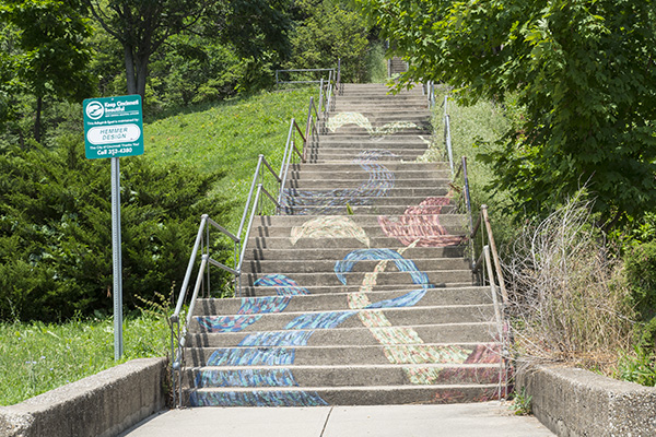
Spearheaded by Councilmember Chris Seelbach, Council agreed to add an additional $180,000 to the $70,000 previously allocated for the support and maintenance of the city’s hillside steps. This amount restores funds for a program that’s been completely defunded since 2013.
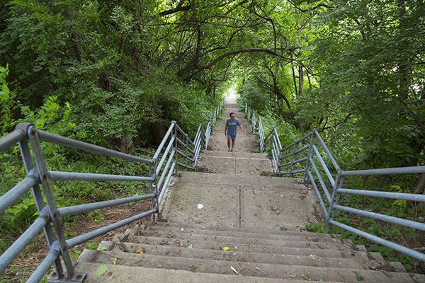
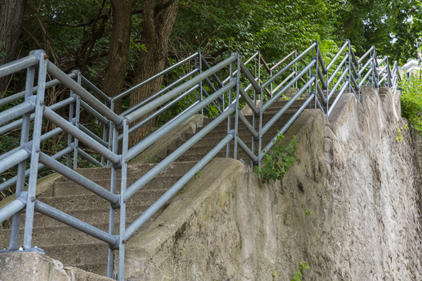
Cincinnati has some 400 sets of hillside stairways crisscrossing through all parts of the city, winding their way up and down in oftentimes historic migratory pedestrian patterns. Check out this link for a meticulously cataloged interactive map of our steps.
At the height of their use in the 19th Century, over 30 miles of hillside steps once connected the neighborhoods of Cincinnati to each other. The first were installed by Mt. Auburn residents in the 1830s in order to gain easier access to Findlay Market in Over-the-Rhine. These days, some are more travelled than others and many have been closed; some are in decent condition, but others are trashed and overgrown.
As a reward for the climb, the ascending pedestrian is greeted at the top with scenic vistas of downtown, the Ohio River and beyond. Not just for recreation, however, the hillside steps are also an integral part of our city’s transportation system and provide a pedestrian-friendly connection to some remote areas of the city.
In the words of Mt. Auburn community activist Carl B. Westmoreland Jr., as quoted in John Clubbe’s exhaustive and learned Cincinnati Observed guide to the city, “What separates Cincinnati from other major cities are the steps, and they are essential. San Francisco has beautiful hills, but most access points are on private property. You never get a really good perspective of the hills, valleys and views unless you are in an expensive hotel or restaurant.” In Cincinnati, however, the steps offer varying and egalitarian perspectives of the city, often crowned at the top by a hillside park such as Jackson Hill, Bellevue, Fairview or Eden.
In order to preserve and maintain the steps, the City of Cincinnati had previously developed the “City Hillside Step Information System” as a means of maintaining an inventory of each set of steps and of tracking inspection and repair information. Unfortunately, the link for that database has gone dead, most likely losing support when the funding dried up at the end of 2012.
Inspired by Council’s newfound magnanimity toward our city’s historic staircases, however modest, I made it a point to get in a hillside trek over the course of last weekend’s 90-plus degree heat and rainforest-like humidity. Living in the basin, this is a fairly easy option, with escapes to Mt. Adams, Mt. Auburn and Clifton all readily available within walking and stepping distance.
My 2012 Soapdish column on this subject focused on the Ohio Avenue and Mt. Adams climbs, so I found it only fitting that we head straight to the Main Street steps, the longest in the network at 354.
The Main Street steps begin at Mulberry just north of Rothenberg Preparatory Academy. The steps initially begin in stages, then plateau for a moment as you bisect some of the quasi-hidden terraced streets that slash west across the hillside from Sycamore Street before halting abruptly on an impenetrably steep Mt. Auburn hillside. Here are streets like Seitz, Goethe, Dorsey and Klotter, all of which offer some impressive views and an almost country-like oasis of quietude just above the urban bustle of Over-the-Rhine and downtown.
The trees and greenery seemingly envelope you in a canopied quilt of branches overhead, making the climb less of a sun-baked, Bataan-style death march and more of a modest rainforest ascent. Following the rail bed of the old Mt. Auburn Incline, visible at the upper reaches of the climb, you find yourself deposited at the top at woefully underutilized Jackson Hill Park, a trusty Cincinnati-made Murdock drinking fountain ready and able to dispense canteen replenishment for the parched Main Street mountaineer.
If you’ve made the climb over the years, you will note the remarkable transformation at the top, where Christ Hospital has all but clear-cut the nearby blocks south of its campus, with the squared dome of the Elizabethan Revival Malvern Place apartments (circa 1880) being one of the few survivors in a wholesale demolition of its former neighbors.
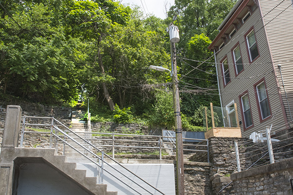
That said, however, you can still find vestiges of “old” Cincinnati nestled — hidden almost — within the hillside. If you continue travelling due north from Jackson Hill Park immediately in the shadows of Christ Hospital off of Eleanor Place, you’ll encounter the Gage Street steps. A jaunt down them drops you into a modest and tidy little neighborhood tucked away beneath the hospital parking structure, which looms above on the cliff like a precast concrete overlord. There’s a certain “land that time forgot” quality to these enclaves on Gage, Rice, Winkler and Calumet Streets, and, while there is no shortage of “Beware of the Dog” signs, it’s almost pastorally quiet.
Continuing along Rice to the north, you reach Inwood Park, and if you cut east through the park via a small set of stairs you will find yourself at another street that’s been recently clear-cut for recent development, Inwood Place. The area off Glencoe just north of the hospital, in a hillside pocket where historic rows of pastel-colored two-bay rowhouses were demolished a few years back, went by a number of names throughout its history: Glencoe-Auburn Place, Inwood Gardens and the Hole were but a few. My favorite moniker for this particular pocket, however, was “Little Bethlehem.”
As described by the WPA Guide of 1946, “In these narrow bowls are nestled communities packed with narrow, crooked streets, stone-paved alleyways with gaslights, and a multitude of solid brick houses on various levels. In this particular pocket lies the section once known as Little Bethlehem. Towering very high above it, appropriately enough, is the gleaming cross of Christ Hospital. On winter nights, when the steep hillside and the streets and homes of Little Bethlehem are snow covered, the view of the cross from the streets far down in the valley distinctly resembles the familiar scenes on Christmas cards.”
These days, it’s hard to imagine that view being familiar with anything other than widespread demolition, as the landscape and its streets have been completely scrubbed of any vestige of their former residents as its prepares for an anticipated future development by Dan Schimberg’s Uptown Properties. In fact, Council just approved the sale of the Inwood Place land to the developer.
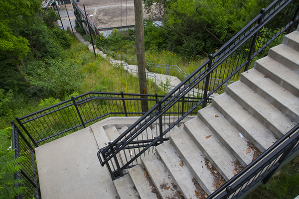
While this trek has lead me far off the beaten path, that’s the great thing about our city’s hillside steps — getting off the beaten path, both geographically and (in the case of this column) thematically. The steps can transport you up and out of the basin and into a whole different viewpoint.
Besides, it’s good exercise, right? According to my iPhone, I notched 21,959 steps on that sweltering Saturday afternoon, almost all of it devoted to a hillside trek (save for a few steps in and around Rhinegeist Brewery during its third birthday celebration).
As I made my descent back to the basin via the wooded Walker Street path and Young Street steps, the inherent appeal of our steps as a viable tourist attraction could not be more evident. That $250,000 allocation could easily be $2.5 million.
“Our hillside steps have a storied history, and for many years the city has neglected these important connections between our working class neighborhoods and the urban core,” Seelbach tells Soapbox. “Despite needing millions in deferred maintenance, it was a huge victory to restore $250,000 to ensure basic upgrades are made to critical steps.”
Only Pittsburgh has more city stairways, and they do a much better job of marketing them. When I see a banner on Eggleston Avenue proudly dedicating $700,000 and cutting 7 feet out of the dog park for a “shared path” under the freeways for pedestrians and bikes (notwithstanding the fact there are ample sidewalks for the few pedestrians and four to five lanes of pavement for bikes), it seems that we could do so much more for our historic staircases.
While $250,000 is a nice re-boot from zero, it should be just the beginning. Once again, stuff like this is unique to Cincinnati and sets us apart from most of our peer cities. Shared pedestrian bike/paths underneath freeways and through culverts? Not so much.
For those interested in getting further involved, please look into Spring in Our Steps, “a consortium of committed Cincinnati residents who feel that forgotten pedestrian spaces can become some of the city’s best assets. The group initiates community-oriented projects in Cincinnati’s alleyways, on its hillside steps, as well as on its most neglected sidewalks, to recreate clean and useable spaces exercises our pride in the community.”
Spring In Our Steps is hosting an “alley walkabout” on Friday, July 1, starting at 6 p.m. and ending with conversation at Arnold’s Bar & Grill.
Related Articles
Fewer options, fuller ERs: The behavioral health fallout of Medicaid cuts
MHA advocates for state funding that preserves behavioral health care and keeps rural hospitals open.

What does the new childhood vaccine schedule actually mean for your family?
Officials say not much will change. Experts aren’t so sure.

New platform to share ‘Common Ground’ from community ideas and solutions
Issue Media Group, a multilocal network of solutions-based, issues-focused digital publications, has launched a new national platform for increasing the reach and impact of its journalism.